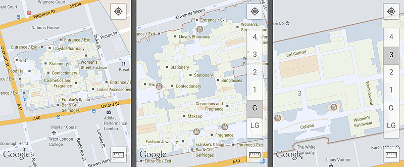
Selfridges London on Google Maps

If you have ever lost in a subway or a shopping mall, you know that indoor maps are indeed useful. I’m not the kind of person who wants to consult info points and -graphics every time looking for the right exit in the underground – but having a map in my phone that helps in these situations: that’s a real deal.

Selfridges London on Google Maps - by Richard Dancsi

I have read sometime in July that the indoor function of Google Maps will be available in the UK, but I didn’t pay too much attention: with my age I already know how to get around in shops and how to look for those signs that give me directions. What’s really great though, is the ease of use. No matter which section, floor or department you are at, the phone is always in your pocket – and you always know which way to go next.

A faster, more effective, happier way of getting around indoors.
j j j

Getting rid of Google Maps

Being dependent on someone else’s technology feels bad. Especially if that someone can an does change it’s pricing from time to time – more so, if those changes could completely bail you out of business. That kind of fear builds mountains – or, for iOS 6 a new Maps service that replaces Google Maps.

Every time I design products where we need to use the Google Maps API, I have a certain feeling: the maps are great, we can estimate the short term costs, but the fact is that we are dependent on one vendor. I’m really glad to see that another player is entering the game now.

That’s the business perspective of course. As a user, I’m simply curious. The first screenshots of Maps are not that great (keep in mind that in Europe, we probably will receive that 3D sugar much much later than users in the US), but by doing my research, I’ve found a really promising fact: the new software is based on the services of C3 Technologies, which is a research lab of the SAAB group.

That means, at least in theory, with this technology creating those high resolution 3D maps might be closer than we think. “Since the high-resolution maps are accurately georeferenced, coordinates can be extracted and used for leading indirect fire such as artillery, as well as close air support targeting.”

And, of course, locating the nearest Starbucks.

j j j